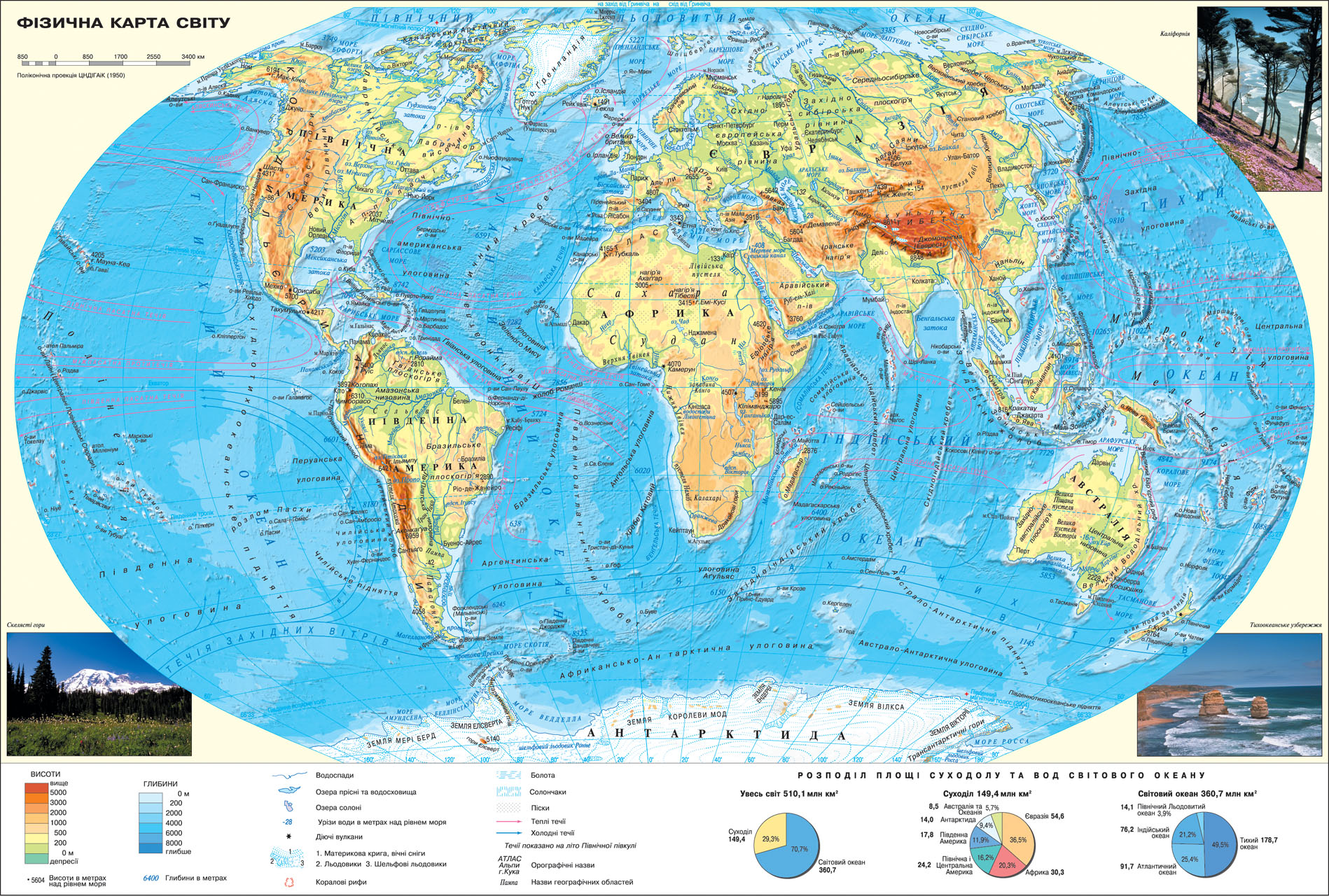
study of geography is impossible without a geographical map, which contains the most objective and accurate concise information about the territory, placing the natural, economic or social objects and phenomena.
On this map more complete than on other maps of the Atlas represented geographic features (islands, peninsulas, bays, straits, seas, etc.). Physical map provides an overview of major landforms land and seabed. It provides orographic names (names of forms of relief): mountains, plains, some peaks of their absolute height above sea level, and the names of forms of relief ocean floor - troughs, ridges, depressions, etc..
hydrographic base maps provided fresh water and salt lakes, waterfalls in the rivers that makes it possible to draw conclusions about the economic use of water land. Thanks shown trends can be drawn about the differences in climate within the climatic zones. Also shown in the desert, wetlands, the spread of saline soils, sands, active volcanoes and signed names of geographical areas (Llanos, Selvas etc.).
Comparing this map with the political will to make generalizations about the prevailing terrain (plain or mountain) in one country, and comparison with a map of population distribution will answer the question why some territory densely populated, while others - not populated.
Comparing this map with the map Mineral Resources , you can trace the relationship of forms of relief with the spread of minerals of different origin (sedimentary, magmatic, etc.).
This map is useful in drawing up the characteristics of natural resources, as well as regional review in assessing the natural resources of the country.
 English