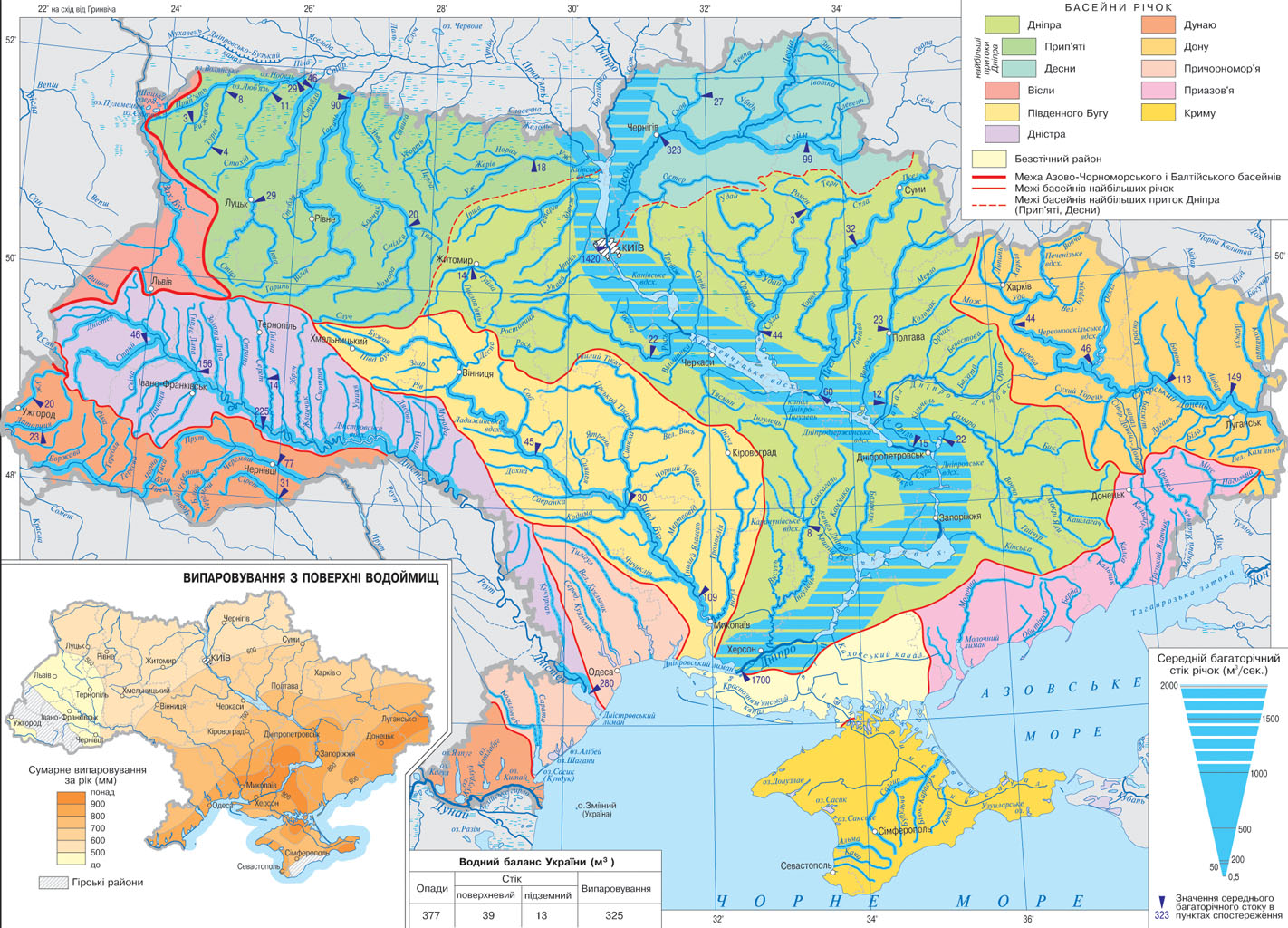
map Surface water gives an overall picture of the surface waters of Ukraine: rivers, canals, lakes, estuaries, reservoirs, marshes. Leading role in the general circulation of moisture needs of economy and population of fresh water is rivers. Ukraine has more than 4 thousand rivers length of 10 km, of which 117 - 100 km. At 1 km 2 area accounts for 0.25 miles of rivers. Almost all the rivers of Ukraine belong to the Black Sea. Only the Western Bug and San belonging to the Baltic Sea basin. Most of the rivers belong to the flat type and feed mainly talymy waters. They have a high flood in the spring, summer, growing shallow and today. Mountain River in the Carpathians and Crimea are rainy power. On cold winter most rivers freeze. Freezing last 2-3 months. Lakes in the country about 20 thousand, including more than 7 thousand square 0,1 km 2 or more, 43 - an area of 10 km 2 and more. The Great Lakes are located in the swamps of the Danube. Bahato lakes and estuaries are closed on the Black and Azov Seas. Lakes of Ukraine of different origin. The largest karst, formed by dissolution of chalk water - Shatsky Lakes in Volyn. Among them is the deepest - Lake. Svityaz (maximum depth 58.4 m). Many in Ukraine floodplain lakes, resulting meandruvannya changes and rivers rivers. These lakes are along the Desna River and Pripyat. In southern estuary many lakes, among them - and Yalpug Sasyk (Kunduk). Among zahatnyh picturesque lakes is Synevyr (Transcarpathian region.), Which was formed as a result of barrage Tereblya valley of rocks during the earthquake. In the Crimea there are relict lakes (remnants of ancient sea basin) - Sasyk, Donuzlav - with salinity over 90 ‰.

 English