§ 9. Atlantic Ocean
Surface Ocean - 91, 7 million км2.
Average depth - 3600 m.
Maximum depth - 8742 m.
1. Remember coasts of continents where washed by the Atlantic Ocean.
2. What strait connects Atlantic Ocean to the Mediterranean Sea and Pacific Ocean?
3. What are the known pilots making its expanses of Atlantic Ocean?
GEOGRAPHICAL LOCATION AND SIZE. Atlantic Ocean is between America and Europe in the west and east Africa. The limits of the Indian and Pacific oceans made conditional - on the meridians of the capes at the southern edges of Africa and South America to Antarctica. The name given the ancient Atlantic Ocean Greek name for the mythical titan Atlas (Atlanta)Who allegedly stood on the edge of the Earth and held on their shoulders round. In different times of ocean called the "sea in the Pillars of Heracles", "Western Ocean", "The sea of darkness." Name Atlantic ocean confirmed in Geography from 1507
Atlantic Ocean - the second largest ocean planet. As and quiet, it extends from the sub-Arctic latitudes to Antarctica (16 000 km). His hallmarks are narrow and elongated shape. And in the north, and south it has a wide waterways with cold polar waters. By deep Atlantic Ocean is the second after the Pacific. Maximum depth is marked in deep Puerto Rico Trench (8 742 m).
Among Sea Atlantic Ocean distinguish internal (Baltic, Mediterranean, Black, Azov) And okrayinni (North, Caribbean). The largest bays are Mexican, Biscayand Guinea. For the size they yield seas.
Most of the islands located near the land and has mainland origin (Ireland UK, Great Antilles). Are volcanic Islands of Iceland, Canary. Coral origin have Bermuda Islands.

Interesting geography
Sea Vegetable
Sargasso Sea is one of the most mysterious seas of the world. His it got the name for cluster in the storied water layer floating brown Sargas algae. Their bundles green-brown spots on the blue prostupayut sea surface. In 1492 Christopher Columbus wrote in his diary: "So many grass, which seemed all the sea is teeming with it. " The Spanish sailors algae covered air bubbles, reminiscent of grape sargo. Hence, the name Sargasso literally means sea grape sea. Interestingly, it has no coast, and its define the limits of ocean currents.
HISTORY STUDY. Atlantic Ocean - the most studied and mastered by people. The first information about it is collected by the Phoenicians thousand years BC. e. However, only in the tenth century. Vikings managed to cross the ocean and reached from the shores of Europe to Greenland and North America. Beginning rapid development of oceans put in XV Art. Christopher Columbus. Followed him carried out by swimming the Portuguese, Spaniards, Englishmen. Since then the Atlantic Ocean became the main waterway on Earth.
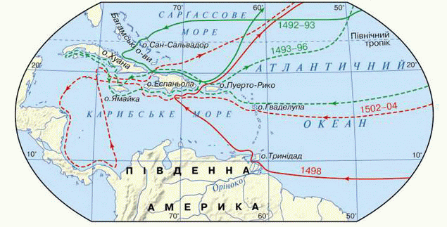
Fig. Christopher Columbus Travel Routes
In the early nineteenth century. Russian expedition John Kruzenshtern and George Lysyansky conducted a study water samples from the depths. Comprehensive studies are started only at the end of the Atlantic century, using specially equipped expeditionary vessels. English expedition on the ship "Challenger" soundings taken depths explored water mass properties, organic world of the ocean. Nowadays, different countries oceanologist world continue to study the bottom water properties and current Atlantic.
Structure and bottom contour. Geologists at rock bottom samples found that the Atlantic Ocean - the youngest ocean Earth. Almost in the middle Ocean north-south stretch of the Mid-oceanic ridges - Northand The North. They form a unique underwater mountain chain length of 17 000 km and peaks which rise above the bottom at 2000 m. Some peaks rise above the ocean, forming volcanic islands. Along middle ranges is fault crust - Rift Valley - wide about 50 km. It is one of the biggest crack in the Earth's surface. In this place the border lithospheric plates, whose movements are accompanied by eruptions volcanoes and earthquakes. Outpouring of magma in the Rift Zone increasing land boards. This bottom of the Atlantic Ocean extends from the speed of 2 cm per year.
On both sides median ridges positioned flat bed Ocean depths of 4 - 6 km. It rises hundreds of volcanic seamount origin. Compared to the Pacific Ocean Atlantic has a wider shelf, especially along the shores of Europe and North America.
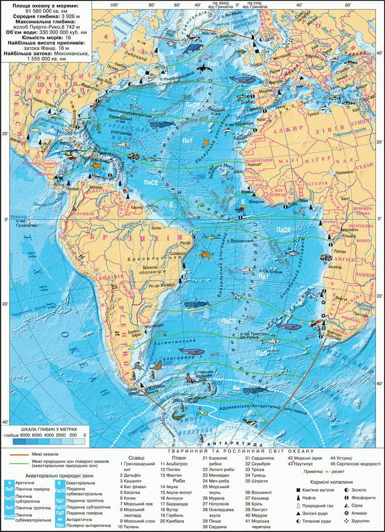
Fig. Atlantic Ocean
Interesting geography
Ancient legends, which over 3 thousand years, talk about Atlantis, the island-continent that allegedly once existed in the Atlantic Ocean. It has said in the works ancient Greek philosopher Plato, who lived in andV Art. BC. e. He writes about land, located on the Mediterranean Sea, which suddenly took over the sea. Already in our time many researchers tried to find Atlantis sank. Some searched for her in western Africa, the second - in the Aegean Sea, the third - Indian Ocean. However, the search proved futile. Until now, scientists debate that Atlantis was or was not, and if there was, what.
Working with map
1. In which hemispheres is the ocean?
2. Which of the Atlantic shelf seas?
3. Give examples of continental islands?
4. Name the warm currents northern Atlantic. How do they affect the climate of Europe?
5. Which direction should reach the Mid-oceanic ridges in the Atlantic Ocean?
CLIMATE. The climatic conditions of the Atlantic are very diverse. This is due to its placement in all climatic zones of the globe. Northern and southern parts of the ocean that are placed in polar and subpolar latitudes, have a harsh climate with negative temperatures for most of the year. In this southern part of the ocean in the northern colder because Antarctica is powerful cooler than the Arctic.
In temperate latitudes of the climate impact west winds, which generate a large number of storms (especially in winter). In tropical latitudes of the trade winds prevail. There observed нayvyschi air temperature over the ocean (30 0С) and naymenshand rainfall. North of the equator have tropical cyclones, which sometimes turn into hurricanes. Initiating the coast of Africa, they are moved to the Caribbean, where the maximum gain strength. In equatorial latitudes down most rain - more than 2 000 mm per year.
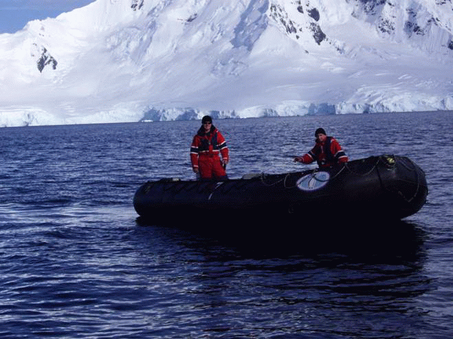
Fig. Atlantic Ocean off the coast of Antarctica
WATER FLOW AND WEIGHT. Water masses differ temperature and salinity. Average temperature of surface waters in the Atlantic Ocean are much lower than in the Pacific. Warmest water (26 0C) - in equatorial and tropical latitudes. Further to the north and south water temperature decreases.
The highest salinity water (37,5 ‰) observed in tropical latitudes, prevailing bezdoschova and hot weather. In coastal Antarctic waters it down to 33 ‰ through desalination as a result of melting ice. Minor water salinity (18 ‰) are areas of ocean where the fresh flow water of large rivers. For example, Amazon at the confluence of the Atlantic Ocean so oprisnyuye its water, even a few miles from the coast can be drink. The feature of the Atlantic are numerous icebergs.
Currents in the Atlantic Ocean as the Pacific, form two range of water circulation. Unlike the Pacific, they do not focus on latitude, and nearly along the meridians. The reason is vytyahnutist of the Atlantic north to south. Currents carry water masses, and with them the warm and cold from one in other latitudes. The best-known heat flow - Gulfstream, which drives warm tropical water north. North of 40 North Atlantic. Both streams heated not only the northern Atlantic, but significantly mitigate climate in northern Europe. For this they are called "water heaters. Above them, formed a warm and moist air masses, so there are clouds, precipitation, cyclones. Westerlies carry them further east - to Europe. From the Arctic Ocean in Atlantic is cold Labradorska currentWhich greatly reduces the temperature in the vicinity.
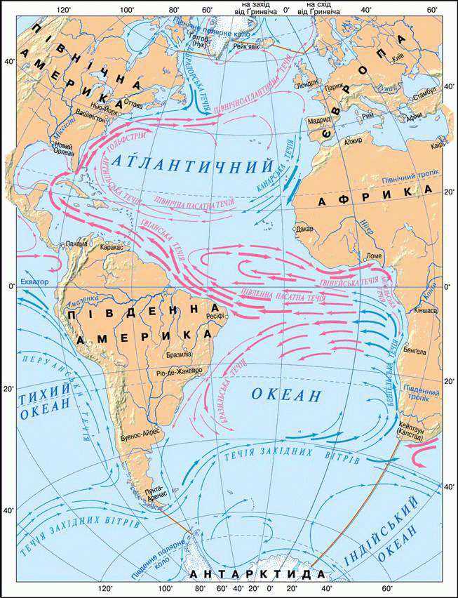
Fig. Atlantic Ocean currents
The organic world.Plants and Animals Atlantic Ocean views poorer than in the Pacific. This is due to geological youth Ocean. Atlantic common different types of algae - red, green, brown (Including the sarhassovi).
The greatest variety of animals living in equatorial and tropical waters. Only where there are flying fish, swordfish, sea turtle. Among the living coral reef barracuda, spynorih, butterfly fish, Angel fish. Only in Sargasso Sea at a depth of 700 m eels spawn, which arrives there from the rivers of Europe and North America. Since mammals are whales, seals. In the cold waters of a small variety of species, but the total number of animals very large. On the coasts of continents and islands of many birds (gulls, guillemot) that eat fish.
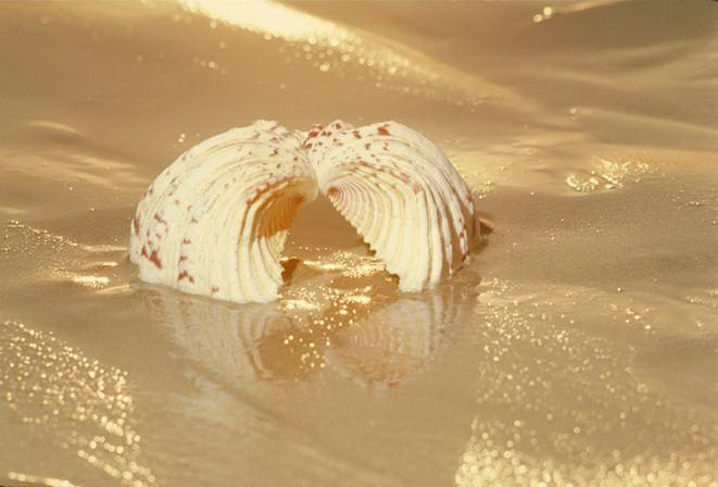
Fig. Marine souvenirs
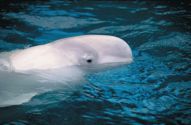
Fig. Beluga
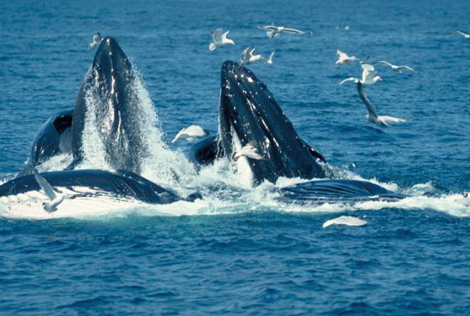
Fig. Thanks to the actions of environmentalists over the last decade in Atlantic Ocean whale population has increased
COMMERCIAL USE. Atlantic Ocean washes the shores most developed countries. Its spaces were built busiest shipping routes, which runs hundreds of passenger and cargo ships. On its shores have largest ports in the world. The coast and islands are great places for recreation and tourism.
Biological Resources used by man since time immemorial. Among Fish is the biggest industrial importance are herring, cod, tuna, anchovies, capelin, sea bass, hake, flounder, sardine. In fish caught oysters, squid, crab bisque, shrimp. In some areas due to excessive harvesting of fish stocks have declined. For their restoration need to reduce fishing for several years.
З Mineral Resources the shelf is oil and natural gas. They develop in the North Sea Mexico and the Gulf of Guinea. Extraction is carried out by platforms installed in the sea. Then oil and gas pipelines, laid down, the pumping of raw storage. Underwater coal deposits developing the UK and Canada. On the shelf near South Africa deposits of high quality diamonds. They are produced by specially enclosed and drained areas. Use and building materials - sand, gravel, limestone-shell. With water getting salt and other substance.
Energy resources Atlantic had mastered. Near the coast France has power, using tidal energy. Country C 0C) and deep (8 0C) water layers.
POLLUTION PROBLEM. Atlantic waters polluted river water flow, coastal cities, oil. Most contaminated sea water areas are ways in which transport the oil. North Sea and coastal waters of North America are covered with oil bahatokilometrovymy spots.
Water pollution leads to reduction of fish. In polluted coastal waters, especially near major ports, emerging viruses dangerous diseases: hepatitis, cholera, typhoid fever. Through that many beaches of the Black, Baltic, Mediterranean unsafe for swimming.
Water pollution prevention lead in different ways. For Ocean Conservation should always monitor and monitoring its condition. In many countries prohibited the drop in the ocean untreated water from industries and vehicles. It should be remembered, the ocean and land - inseparable. Unable to save the ocean, people can hardly and keep dry.

Questions and Tasks
1. Compare the geographic location and size Atlantic and Pacific Oceans.
2. Why middle of the Atlantic have seredynnookeanichni ranges?
3. Why is water near the Atlantic coast Antarctica is of lower salinity?
4. Tell us about the organic world of the Atlantic.
5. What riches lie in the waters of the Atlantic Ocean?
6. As a result, ocean waters are polluted?
7. Consider why the North Atlantic called the kitchen weather in Europe.
8. Using the card "The structure of the Earth's crust, specify:
a) that lithospheric plates form the bottom of the Atlantic Ocean;
b) in what direction and how fast they are moving;
c) are landforms formed on the bottom as a result of these movements.
Practical work
1. Sign in contour map names: Islands - Iceland, Bermuda, Cape Verde; submarine ridges - North, The North.
2. Mark the corresponding colors are warm and cold currents and sign their names - Gulf Stream, North Atlantic, Labradorska, Canary.
 English