§ 16. Geographic Coordinates
1. Remember that imaginary line is on the map and map.
2. Where on the map and the maps made the equator?
Parallels and meridians that form a grid Degree, have their mark on the frame map or globe. They are intended to determine the latitude and longitude objects.
Geographic latitude. Distance in degrees of any point of the surface to the equator is called Geographic latitude. Geographic latitude varies from 00 900. For the starting point of reference serves as the equator, which has zero latitude. Pershu parallel north of the equator mark the 100The second - 200, Third - 300 etc. The same numbering (100, 200, 300 etc.) are parallel and are printed on the south of the equator. These numbers indicate latitude location. All points located on the same parallel, have the same latitude.
There latitude north and south. All points located north of the equator, in North HemisphereHave North latitude (пн. sh.). Points, aresouth of the equator, in South HemisphereHave South latitude (AP. sh.). The maps latitude parallels sign along the side frame, and globe - at the intersection of the meridians 00 and 1800.
How to determine latitude? That determine the breadth of any object, you must define a parallel in which he nahodytsya. For example, City Cairois parallel toWhich is distant from the equator 300 north, so it latitude - 300 пн. sh. The maps parallels conducted in 100 or even 200. ТWMD not all of the world are on marked parallels. If the object is situated between two parallels, should:
1) latitude to determine the closest parallel to the object (of the equator);
2) add to this number of degrees of latitude from the parallel to the object. For example, city Delhi Located between 200 and 300 пн. sh. Nearer the equator parallel - 20-a. Determine the number of degrees that corresponds to a distance of 20 th parallel to Delhi - is about 90. So its latitude - 290 пн. sh. (200 + 90 = 290).
A how to determine latitude for map of Ukraine, as it is marked equator? In this case the count from the first marked the most southern parallels.
Geographic. To find the object on the map, not enough to know where he geographical breadth located. For a parallel passing through many locations around the globe. Therefore, in addition to latitude and longitude know. Geographic longitude - Is the distance in degrees from any point of the surface to zero meridian.
Counting longitude begin from zero, or initial, meridian. He divides the globe into two hemispheres - Westernand Eastern. On the map of meridian counter reaches zero (00), Has longitude 1800. Thus, the longitude varies from 00 1800 in both hemispheres. All points of the earth's surface, located east of the zero meridian opposite to him on 180, that is in the Eastern hemisphere, have east (SH. d.). The points are located to the west from the zero meridian to 180 th in the Western Hemisphere, have Western longitude (зх. d.). All points are located at prime meridian have a longitude 00.
On globe and map the value of meridians (100, 200, 300 etc.) signed on the equator. It hyslo and specifies their longitude.
How to determine longitude? To determine geographic object, you need to find the meridian on which it located. For example, if city Santiago located on the meridian, which is far from a zero to the west at 700, then its length - 700 зх. d. If the object located between two meridians, the procedure is as follows:
1) learn a longitude meridian closest to the object (from zero);
2) it added to the number of degrees from the meridian to the same object. For example, Beijing located on the zero meridian to the east between 110 m and 120-m. Distance 110 th meridian (counting from zero are having) about 6 to Beijing0. So, its geographical longitude: 1100 SH. D 60 = 1160SH. d.
Geographic coordinates. Parallels and meridians can hold through any point of the globe. However, because each point can hold only one parallel and only one meridian. Then there is the intersection of lines north-south and east-west. The point of intersection provides a permanent address any geographical object.
So, point the earth's surface can only have one latitude and a longitude. Latitude and longitude points it is geographic coordinates. They point to the exact position of this point on the earth, determining її a geographic address.
To find the object on the map at the desired geographical coordinates:
1) determine in which hemisphere (North or South, West or East) to search point, in latitude and longitude numbers find the corresponding parallel and meridian;
3) to follow them to the crossing point. For example, geographic coordinates Kyiv – 510 пн. sh. 310 SH. d.
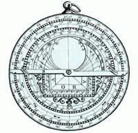
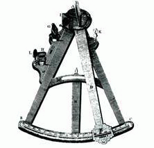
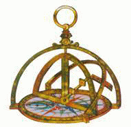
Fig. Ancient navigational instruments
 FAQ
task
FAQ
task
1. For a map hemispheres determine latitude cities of Berlin, Buenos Aires.
2. With physical map of Ukraine define the breadth of Lutsk, Simferopol.
3. What latitude is the equator, North Pole, South Pole?
4. Is it enough to know only the latitude to determine the location of the object map?
5. For a map hemispheres determine longitude Yakutsk, San Francisco, City Aconcagua.
6. With physical map of Ukraine determine longitude Uzhgorod, Zhytomyr, Dnepropetrovsk, Lugansk.
7. Identify the geographic coordinates of the island Kerguelen.
8. In the 1821 expedition discovered the island. Its location - 69 PD. sh. and 91 зх. d. How is it called and where is the ocean?
9. Jules Verne's novel Hero Captain Grant after the accident, the ship managed to reach the Island Tabor (370 AP. sh. 1530 зх. etc.). Show this island on the map.
10. The sailors found a bottle in the ocean, which was a note. Victims of ships was in a strong storm, asked for help. Water that has penetrated into the bottle destroyed some inscriptions. Preserved only the following passages: 42 ... sh. And 173 ... D., near island... Nob... As called islands, near where the storm hit the ship?
11. With geographic coordinates define objects on the map hemispheres:
a) The highest waterfall of the world - 60 пн. sh. 610 зх. D.;
б) big island, where the smallest inhabited napivmavpy (Their body length 12 cm) - 19 AP. sh. 47 SH. D.;
c) object, which in 1856 opened the British traveler David Livingston – 180 AP. sh. 260 SH. d.
Interesting read
1. Gordeev, A., Shevchenko in. Secrets maps Piri Reis. - Vinnitsa, DP TCF, 2005.
2. Zhupanskyy J. Your companion - map. - K. Soviet School, 1985.
3. Zahorodniy V., MatusyevychK. Fundamentals of topography and cartography. - K., The Soviet School, 1977.
4. A. Roshchin Interesting geodesy. - K. Soviet School, 1973.
 English