§ 43. Geographical Location
1. Remember that part of the world differ in Eurasia.
2. Compare with other dimensions of Eurasian continent.
Area - 53,4 million км2.
Population - 4.6 billion people.
Average height: Europe - 300 m Asia - 950 m.
The highest point on RM - G. Dzhomolungma (8848 m)
GEOGRAPHICAL PROVISIONS. Eurasia - a continent in which we live. It is the largest continent on the planet. Its area is almost third of the total land area of Earth. Eurasia - the only continent that is washed all four oceans of the Earth. Much of its length from north to south (in 8500 km) postulated a placement in all geographic zones of the Northern Hemisphere. Even more is the length from west to east - a 16 000 km. This causes extreme variety of environmental conditions.
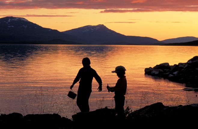
Fig. Lake in polar bears. Sweden
You already know that in Eurasia distinguish two parts of the world - Europe and Asia. Name Europe derived from the Phoenician word: „Erebus” – west, а Asia – from the Assyrian words "CAM" - east. Idea of them as different parts of the world happened in ancient times, much earlier than people learned about the true size of the entire continent. Therefore, this division is not geographical and historical only. Boundary between Europe and Asia hold conditionally on following objects: the eastern foot of Ural Mountains – Emba River - Northern coast Caspian Sea – Kuma-Manytska depression – Azov and Black Sea – Strait Bosporusand DardanellesThat connects the Black, Marmara and Mediterranean seas. Bosphorus width at the narrowest place only 700 meters Strait is the narrowest in the world (at the length of 30 km). Built through the Bosporus bridges that connect Asia with Europe.
Asian part of the mainland is much larger in area than European, which is issued only large peninsula of Asia. In Europe it is impossible away from the coast by more than 600 km. Instead, internal areas of Asia so distant from the sea than anywhere else on the globe (more than 1500 km).
Eurasia close to Africa, from which it separated only a narrow strip of water - Gibraltar strait, Suez Canal and Red Sea. Similarly, only a narrow Bering strait separates Eurasia to North America. From other continents its separating the broad expanse of oceans.
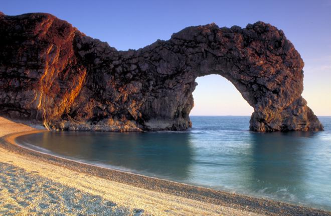
Fig. Sea coast in southern British
Coast LINE. The end points of Eurasia are: the north – Cape Chelyuskin Taimyr Peninsula on, South - Cape Piay Malacca peninsula on the west - Cape Roca on Iberian Peninsula, east - Cape Dezhnova in Chukotka Peninsula.
Eurasia Shores strongly articulated. In the western Atlantic deep in the ocean can not constitute its internal Black, Azov, Mediterranean and Baltic Seas, vyokremlyuyuchy Crimean, Balkan, Apennine, Iberian and Scandinavia.True to resort to the mainland and large bay - Biscay and Bothnia. Islands lie off the coast United Kingdom, Ireland, Sicily.
Instead okrayinni Sea Arctic Ocean such as Barents and Shidnosybirske resorted to shallow land. The largest peninsulas in the north of Eurasia is Taimyr і Chukotka. At some distance from coast many scattered islands and archipelagos – Svalbard, Land Franz Josef, New Earth.
Heavily cut shores of Eurasia and the east. Okrayinni Sea Bering, Okhotsk, Japanese, Yellow, East China, Pivdennokytayskeseparated from the Pacific peninsula (Kamchatka, Korea) and chains of islands (theSakhalin Japanese Islands).Near the southeastern coast of mainland placed Philippine, Small Sunda таBig Sunda (Covering Islands Kalimantan, Sumatra, Java) Islands. Sumatra Island from the peninsula Malacca separates Malacca strait, and from the island of Java - Sunda Strait.
In southern Eurasia, its size allocated peninsulas Indo-China, Malacca, Hindustan, Arabia. Deeply resort in mainland big bay - Siamese, Bengali, Persian, Aden and okrayinne Arabian Sea.
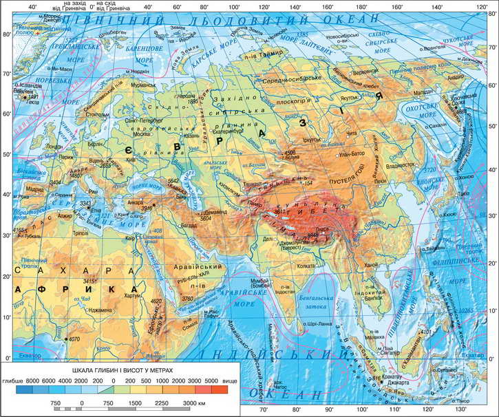
Fig. Physical map of Eurasia
Working with map
1. Find and fix errors in the description of geographical provisions of the continent: "Eurasia is located west of Africa to the south - from Antarctica, the north - from North America. Its northern coast is washed Atlantic waters and eastern - the Pacific Ocean.
2. Determine which part of the mainland coast line divided most.
3. What strait separates the island from the UK coast of Europe?
4. What strait separates the island Sakhalin and the Japanese?
5. What northern seas washed coasts of Eurasia?
6. Name the large objects Coast line to the southern mainland.
7. What bodies of water separated Eurasia from Africa and North America?

FAQ task
1. Compare location Eurasia and North America. What are their similarities and differences geographical location?
2. Prove that the coastline Eurasia strongly divided.
3. What continents are the closest Eurasian neighbors? On which continents is far distant?
4. Where is the border between Europe and Asia?
5. Determine between which parallels Eurasia located. Compare its length from north to south with length of other continents. Determine which meridians located between Eurasia. Compare its length from east to west length of the other continents. What conclusions can be drawn?
Practical work
1. Determine the coordinates of extreme points of Eurasia.
2. On the contour map:
a) mark and sign the name of extreme points of Eurasia;
b) sign the sea - North, Baltic, Barents, Shidnosybirske, Bering, Okhotsk, Japanese, Yellow, East China, Pivdennokytayske, Arabian, Red Mediterranean, Black, Azov; Bay - Biscay, Bothnia, Siamese, Bengali, Persian, Aden; Straits - Gibraltar, Channel, Bering Sea, the Bosporus, Dardanelles Laperuza, Malacca, Sunda; Peninsulas - Crimean, Balkan, Apennine, Iberian, Scandinavian, Taimyr, Chukotka, Kamchatka, Korea, Indo-China, Malacca, Hindustan, Arabia; Islands - Svalbard, Earth Franz Josef, New Earth, Sakhalin Japan, Great Sunda (Kalimantan, Sumatra, Java), Small Sunda, Philippine, UK, Ireland, Sicily.
 English