SUBJECT 3. GEOGRAPHIC RESEARCH IN UKRAINE
§ 8. Begin research in Ukraine
1. Remember who renowned Greek scholars in ancient times, been to the lands of the Ukraine.
2. Who created ancient maps?
The first information about Ukraine. The first geographical data about the territory of Ukraine preserved since time immemorial in the works of Greek historians, geographers and travel - Herodotus (V Art. BC. E.) Strabon (I cent. To BCE.) Ptolemy (II c.).. In their writings they described the south of Ukraine, most of all - Black Sea, where there were Greek city-states. Depicting the nature of the territory, the scientists noted its wealth, especially the powerful dark soils wide flowing river, beautiful pastures for livestock. Later, Arab and Byzantine travelers describe life, culture and economy of people who lived on the lands of the Middle Dnieper and the Northern Black Sea .. They mention the hospitality of the people, their peaceful nature. Since ancient times reached us and the first mapping images of these areas.
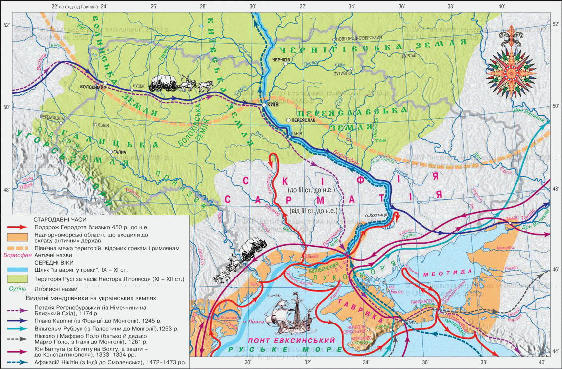
Fig. Geographic information about the Ukrainian lands in antiquity
 Ukraine amazing
Herodotus - Father of Ukrainian history
Scythia - "A country in north Black Sea coast and adjacent lands "- the most detailed way described by the ancient Greek scientist and traveler Herodotus in IV his book "History", known as the "Scythian logos. He therefore rightly be considered the "father of Ukrainian history. Greek scientist who visited the northern Black Sea coast, defined length the Black Sea coast, described the river that flow into it, the hollow distance between separate settlements. In the twentieth century. published the first translation IV Ukrainian language books "Herodotus of Halicarnassus. Scythia. The oldest description of Ukraine V century before Christ "(1937), and later Seeing translated "History in nine Book "(1996).
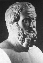
Fig. Herodotus (485 - 425 years to district. E.)
Information day in the Middle Ages. After formation Ancient state Kievan Rus due to Arab and European travelers and merchants, information about the territory of Ukraine are spread in world. Their reports contained geographical information on individual Ukrainian lands, economic and political life on them.
The first mention of the domestic territory of our country is in the chronicles, prince's letters, literary works. In the oldest chronicle The Tale of Bygone Years ", author takes first title Rus (862), attempts to answer the question: "Where she went Ruska land? ", Describes its nature, describes people who inhabited these lands, their political and trade relations with other countries, carried out by land, sea and rivers, including including "Varangians by the Greeks on the Dnieper River and Black Sea. In Kiev and Galicia-Volyn chronicle used the name "Ukraine" (1187). They there is information on the establishment of ancient cities, building castles, churches, settlement and exploring new territories by our ancestors.
After conquest of the Ukrainian lands Lithuania and Poland geographical data about our area contained mostly in the chronicles and documents of government of these states, and with the development of Zaporozhye state - in the Cossack chronicles. At the time, increased European interest through Ukraine and its people, as evidenced diaries, reports, and reports of Italian, French, German, Austrian, Swedish travelers and messengers and travelers from the Arab East.
Ukraine amazing
Medieval travelers to Ukraine
У XIIArt. Kyiv thrice visited Arab writer and scholar Abu Hamid. In his book "Anthology of some wonders of the West" and "cosmography" he details described the nature, economy, trade and lifestyle of the population of Russia. Details is also found in the Arab travelers Al-Idrisi (XIIcent.) and Ibn Battuty (XIVc.).. Information about Ukraine spread and our compatriots, who studied at universities in Europe. Among them - the scholar XVArt. George lived in what became the leader of Bologna University, taught medicine and astronomy.
The first Ukraine map. The first maps of the entire Ukrainian territory were submitted rewriter "Geography" of Claudius Ptolemy, since XIII Art. This book reprinted over 50 times. In ancient ptolemeyivskyh maps added new ones. Originally they were hand-written cards, and in the XV - XVIII century. - printed. Ukraine was visible on the world map, Europe and some states - Poland, Lithuania, Hungary, Turkey and Russia. Instead, in the 1650-1660 biennium Western Europe came first map devoted exclusively to Ukrainian lands. Their author - French military engineer and cartographer Guillaume de Boplan. Being an engineer and military installations cartographer in the service of King of Poland, he spent 1917 in Ukraine. He often traveled personally performing topographic measurements for Style maps. Boplan made several general maps of Ukraine and its individual parts (Kyiv, Podolia, Volhynia, etc.). and a map of the Dnieper. Its author of "Description of Ukraine", which described in detail its nature, Settlements, roads, employment and life of residents. Maps and books where G. Boplana researchers called the pearl in Ukrainian literature of XVII century. These works were and remain a valuable source Information about Ukraine and Ukrainian people of the time.
Ukraine amazing
Warning to readers' Description Ukraine "
.. dare in full respect present? description of this great country boundary of Ukraine, lies between Muscovy and Transylvania. On the attached map can in an instant seen from every point of view this space land in Ukraine? Gentlemen, I suggest you map which is made of a strange story, or some collection, but based on precise measurement made by me in all places land on the map. This should You upevnyty the accuracy, as well as the veracity of my words. Enjoy, therefore, the fruits of my free time work, looking at your offices on this good land, the location of cities and fortresses, which I have outlined, would appreciate that your laudable curiosity will find this fun. "
Guillaume Ле Wasser Sierra de Boplan, 1651 р.
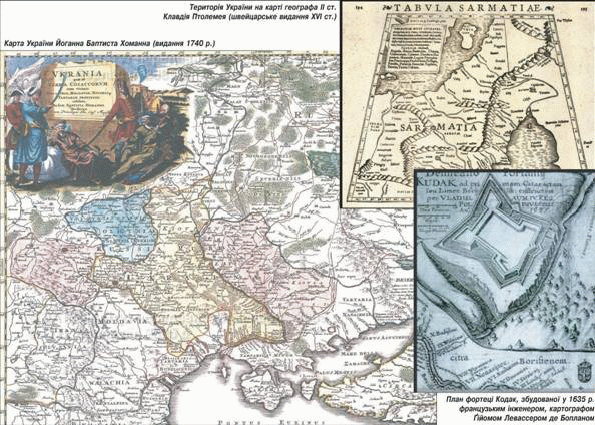
Fig. Ancient Maps of Ukraine
Remember
The first geographical information about Ukraine contain the works of Greek scientists and Travelers - Herodotus, Strabon, Ptolemy.
The first mention of the Ukrainian national land is in the chronicles and princely deed. Name "Ukraine" was first mentioned in chronicles in Kiev 1187
The first detailed map of Ukraine was a French cartographer Guillaume de Boplaninside XVII art.
 Questions and Tasks
1. In what sources we find the first location data about the territory of our country?
2. Why Greek scientists age of antique interest in Ukraine? What part of it they knew best?
3. In what sources , the first mention of the domestic geography of medieval Ukraine?
4. When and why increased interest of Europeans to the knowledge of the territory of Ukraine?
5. Who was first detailed maps of Ukraine?
6 *. It is known that the ancient Greek historian Herodotus visited the northern Black Sea coast, described Ister, Tiras, Borisfen, Hipanis, probably visited Olbia and Chersonese. Recall the history of Ukraine, which geographic features in question.
 English