Established October 15, 1932
Area - 31,9 thousand square meters. km, 5,3% of Ukraine, 3 among its regions
Administrative Center - Chernihiv
Territory - 71,3 sq. km. km
Population City - 297,8 thousand people
number of districts - 22
Bridge - 16, including the cities of regional subordination - 3 (Slavutych subordinated to the Kiev region)
Top City region : Chernigov, Nizhyn Priluki, Bakhmach, Nosivka, Garden, Novgorod-Seversky
settlements City type - 29
Rural settlements - 1486
Population - 1 115.5 thousand people (on 01/08/2009 was)
Density population - 35 inhabitants per 1 square. km
City : 692,8 thousand people
Agriculture : 422,7 thousand people
National warehouse : Ukrainian - 93,5%, Russians - 5,0%, Belarusians - 0,6%
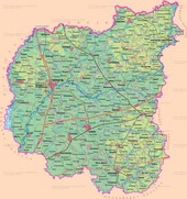
lies in northern Ukraine, on the left bank of the middle reaches of the Dnieper River in the basin of the Desna. The surface area - mostly low-lying and flat, sometimes - polohohvylyasta plain, bent to the southwest. It lies in the Dnieper lowland. In the north-eastern region circulated Karst (funnel, karst abyss). In the Southeast - increased hilly-wavy parts located within the Poltava plains (100-220 m). It is dominated by erosion-accumulative relief forms (ravines, gullies) in combination with accumulative glacial and water-glacial shafts. On the sandy terraces - aeolian landforms (ridges, hills, dunes). In the floodplains of the Dnieper, the Desna River and its tributaries waterlogged surface covered with peat bogs. In Chernihiv region has a variety of minerals. The importance of having fuel - oil and natural gas (northern Dnieper-Donets oil and gas field). The most significant deposits of peat - in Ripky, Chernihiv and Semenovskoe areas. Industrial importance limestone, gypsum, chalk, sand (glass and building), marl. There are about 15 deposits of clay suitable for making tiles, tiles, pottery and art pottery. Ichnyanskom area operated only deposit in Ukraine bischofite unique for their medicinal properties and stocks. There are mineral springs.
temperate climate with sufficient rainfall, warm summers (18 °, 19,5 ° in July) and relatively mild winters (-6 °, -8 ° in January). Rainfall per year - 550 mm (in the southern and central parts), 580 mm (in the northeast). Rivers length of 10 km - 196. Major rivers - the River (on the western border region) and its left tributary of the Desna River and its tributaries (Sejm, Doch, Oster - left, Ubid, Maine, Snov, Bilous - right). In the northwest, the flowing Sozh (tributary of the Dnieper River), and in the south - Uday (tributary Sula). In 1915 the region built 675 reservoirs and ponds to the area of the Kiev reservoir belongs. There are many floodplain lakes in the Valley Again - karst lake dip. In northern region dominated by sod-podzol soils in the South - black and deep vyluhovani ashed. Common light gray forest, dark gray-ashed, and river flood plains - meadow and marsh soils. Main znahodyattsya woodlands in the north, on the rightberezhzhi Gums: mostly coniferous pine trees and oak-pine subordi. In highly-developed industrial region growing oak, hornbeam-occurring oak forests. In the floodplains of rivers grow black alder, willow, poplar, on river terraces - bows. Wildlife pretty diverse, has more than 400 species, including mammals - 48 birds - 286 species of amphibians - 11 reptiles - 7, fish - 50. Among the adverse natural processes prevailing plane wash, wind erosion (North) Karst (south east). The northwest part of radioactively contaminated area of Chernobyl NPP. Reclamation: Conservation practices, wetland drainage, followed vodorehulyuvannyam. In the 642 territories and objects protected areas, including state value: 11 nature reserves, 7 natural monuments, park, zoo, park, monument of landscape architecture, 49 natural reserves.
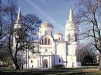
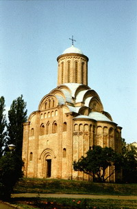
In VII-VIII century. in modern Chernihiv region lived Siveryany Eastern Slavic tribes. From the X century. Chernihiv-Siver land was part of Kievan Rus. In 907, the appear the first mention of Chernivtsi. Since 1024 city became the center of Chernihiv principality, and the size and importance second only to Kyiv. These are the many monuments, which together with the Kiev temples have golden fund of Ukrainian architecture. In 1239 Chernihiv region were destroyed and burned by Mongol-Tatars. Later Chernihiv was the property of Lithuania - the XIV century., Muscovy - from the beginning. XVI century., Poland - beg. XVII. After the National Liberation War of 1648-1654 Chernigov land administratively divided into 4 regiments that existed prior to 1775 Hetman was the residence of Baturin. In the Northern War the city was completely burned by Russian troops (in 1708). In 1802 was established ChernigovMali province. Great losses suffered Chernihiv during World War II, but was able to rise from the ruins, and many times over the centuries of its existence.