Established December 4, 1939
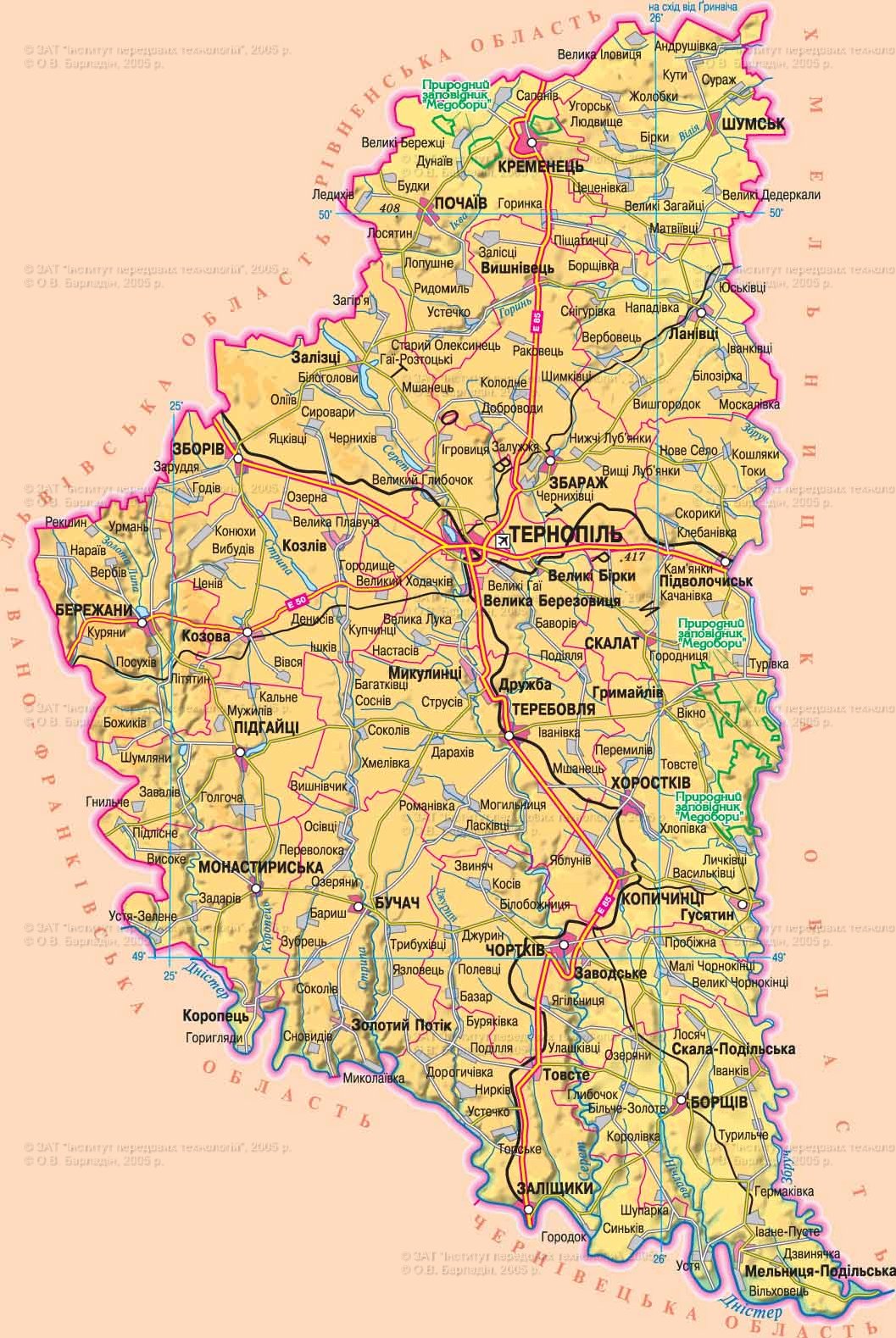
Area - 13,8 thousand square meters. km, 2,3% of Ukraine, 23 among its regions
Administrative Center - Ternopil
Territory - 37,6 sq. km. km
Population City - 218,0 thousand people
number of districts - 17
Bridge - 18, including the cities of regional subordination - 1
Top City region : Ternopil, Chertkov, Kremenets, Bershad Terebovlya, Buchach
settlements City type - 17
Rural settlements - 1023
Population - 1 090.9 thousand people (on 01/08/2009 was)
Density population - 79,1 inhabitants per 1 square. km
City : 474,0 thousand people
Agriculture : 616,9 thousand people
National Structure : Ukrainian - 97.8%, Russians - 1,2%, Polish - 0,3%
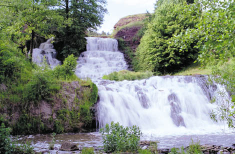
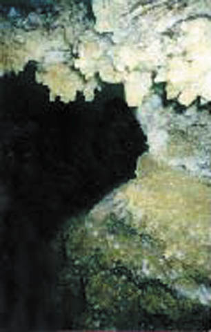
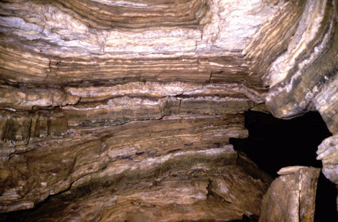
lies in the western part of Ukraine on tail. Most of the area lies within Podolsk Upland and Northwest part of it - within the plains of the Small Polesie. The overall slope surface - from north to south. In the extreme northwest lowland polohohvylyasta surface, it occurs inselbergs sedimentary rocks (210-250 m). From northwest to southeast across the central part of the region Tovtry (12.6 km width, height 380-400 m). The surface of Transnistria (120-170 m) polohohvylyasta, Lesova deeply divided canyon river valleys, gullies and ravines. In the Southeast - karst landforms (cave). Ternopil region is rich in non-metallic minerals (300 deposits): limestone, chalk, marl, gypsum, quartz sand, clay brick and tile and other building materials. Fuel resources presents negligible reserves of brown coal and peat. There are mineral springs. The climate is continental with mild winters (-4,5 °, -5,5 ° in January) and warm, humid summers (18 °, 19 ° in July). Precipitation 600-800 mm (north-west and east), 520-550 mm (southeast) a year. In the region 120 river length of 10 km each. They belong to the basin of the Dniester (Golden Lime, Koropets Strypa, Seret, Zbruch Nichlava) and Pripyat (Gorin, Ikva, Vilya). There are 14 reservoirs and 246 ponds. Soils dominated by light gray, dark gray-ashed (51%) and ashed black, black type malohumusni. Natural vegetation covers about 19% of the area, including: meadow - 7%, 1,2% - swamp. The area of forests is 158.8 thousand ha (hornbeam, oak, beech, linden, north - pine, birch, in river flood plains - black alder). Flora of the region many endemic plants. The wildlife includes 305 species including: mammals - 61 birds - 187 species of reptiles - 10, amphibians - 11 fish - 36. Adverse natural phenomena: plane wash, karst processes and landslides on steep slopes of river valleys, the flat interfluve - bybolochuvannya. Reclamation: afforestation erosion, clearing of small river. In the 541 territories and objects protected areas, including national importance: Reserve, 14 nature reserves, 11 natural monuments, botanical garden, 2 Arboretum, four park monuments of landscape architecture, 3 regional landscape Parks, 4 reserve tracts.
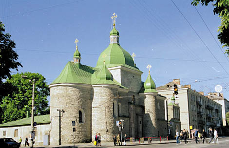
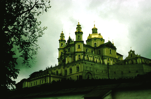
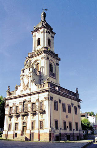
from princely times in the Ternopil region left more than 300 settlements and villages and 100 necropolis X-XIII centuries. At the end of XI century. Terebovlia principality emerged, which later became part Galician land. In 1672 much of the region came under the rule of the Turkish sultan, and in 1927 went to Poland.
With the industrialization era of European countries in the second half of XIX century. in present-day region 8 of steam and 680 small water mills, 170 distilleries and breweries, whose number in 1910 increased to 390. Important for the development of the region was building railroads started at the end of XIX century.
During World War II area has suffered considerable damage. In the postwar years, the agro-industrial farm land has been rebuilt, there were new industries: machinery, instrumentation, chemical and others.


 English