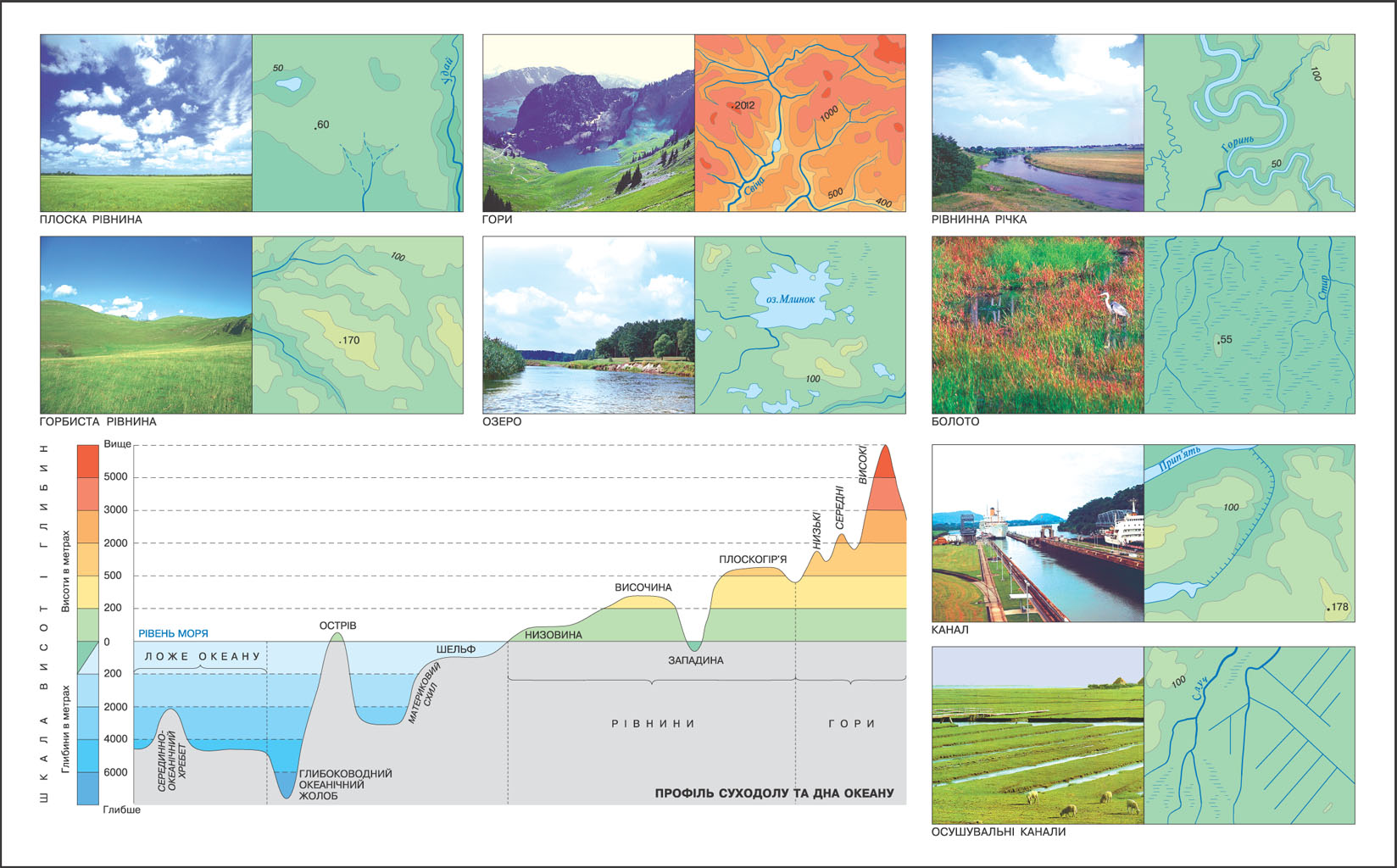
With learned in previous classes and your own experiences you know that the surface is uneven. On Earth there are mountains, plateaus, hills and hollows. All the irregularities of the earth surface is called relief. For a more complete image areas on the maps, there is a need for a relief image. To properly portray the relief you need to know the absolute and relative heights of objects. Absolute height - a height of object above sea level, taken at 0 m. In our country, beginning in the adopted reference height level of the Baltic Sea. Relative height - is the excess of one object over another. For example the absolute height of the tallest peaks in Ukraine, Hoverla mountain, is 2061 m above sea level. However, its relative height of the foot to the top, is much less, because the foot of the mountain is also located above sea level.
In terms of terrain and topographical map depicting terrain by contour lines - lines connecting points with identical absolute terrain height. One is not a horizontal view of landforms, need several horizontal. They are held at regular intervals of height, depending on map scale. These intervals may be 1 m, 2,5 m, 5 m, etc. Indicate the peak point, indicating its absolute height. With contoured to determine the nature of relief: the closer horizontally positioned from one another, the cooler side, and vice versa. Direction of slopes indicate short lines - berhshtryhamy. They are placed near horizontal free end downwards relief.
In addition to contour images using relief or hypsometric layer with painting: the above or below sea level, the darker the color. Traditionally, a yellow-brown palette for Terrain land and blue-purple - for the relief of the seabed. Degrees of the scale are clearly distinguished, but not be too dramatic. Successfully completed layer with color, creating a relief effect vypuklosti the map does not complicate the perception of its contents.
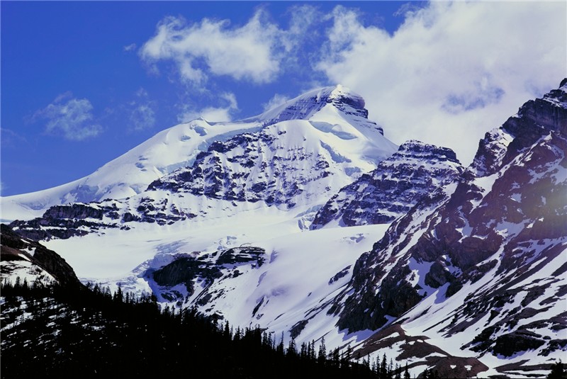
The basic forms of relief include land and the mountain plains. For the absolute height of the mountain are: low - up to 1000 m, average - between 1000 and 2000 m high - more than 2000 m.
The mountains produce separate peaks, mountain ranges, consisting of interconnected mountains and mountain valleys - fall between mountain ranges. Narrow and deep mountain valley called Canyon. All plains are divided into lowland (altitude of less than 200 m), height - from 200 to 500 m and a plateau - 500 m. Lots of land, located below sea level, called hollows.
Bevel the bottom of the oceans is also varied. The basic forms of relief include: Shelf - submerged coastal mainland with a depth of 200 m, marginal, which rapidly dropped to a depth of 2000 m sea floor - deep part of the bottom. In the bed is dominated by deep-ocean plain, but common and submarine ridges, deep grooves and volcanoes with flat tops. Underwater mountain that reached the ocean surface, forming islands. The largest underwater mountains formed on the edge of lithospheric plates. They are called the Mid-ocean ridges, reaching up to 2000 m altitude and extending thousands of kilometers.
LAND ON THE PLAN AND MAP

 English