map - this is one of the models of reality, so depending on what needs to be modeled in the case, create different types of cards.
By volume allocated territory map (depicting all the Earth's surface), hemispheres, continents and their parts, maps, etc. states.
scale is small-scale maps (up to 1:1 000 000), medium-sized (from 1:1 000 000 to 1:200 000) , large (from 1:200 000).
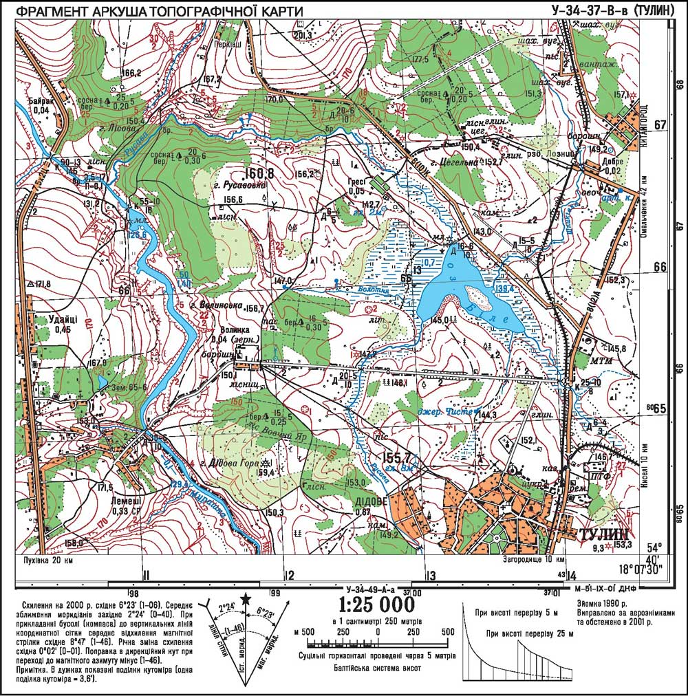
for content maps can be zahalnoheohrafichnymy and themed . Thematic maps are divided into two groups: geographical and economic and geographic . In zahalnoheohrafichnyh maps key element of surface is placed on it objects. Topographic maps - large group zahalnoheohrafichnyh cards that include their own topographic maps (scale 1:200 000 and larger), and survey and topographic (scale of 1:200 000 to 1:1 000 000). Topographic maps, which is the source of various information about the locality are used for precise measurements and calculations to create special maps (geological, soil, etc..) As well as for direct targeting areas. At the fragment scale topographic map sheet 1:25 000 shown and described basic geodetic points, settlements, structures, buildings and some local items, railways and roads, wire transfer lines, administrativeand boundaries, terrain, hydrographic network, vegetation, soils. List of basic objects that are represented on topographic maps are presented in symbols for topographic maps of scale 1:25 000.

 English